

Trek Between the summits and glacial valleys of the Tian Shan - Khan Tengri Peak - Kyrgyzstan
10-day trek east of Kyrgyzstan to the borders of China with views of splendid glacial valleys and isolated mountain lakes.
In stock: 10
1 560,00€ inc. tax
Meeting place :
Difficulty levels :
(Click on the pictograms for more information)
| Technique : | Effort : | Risk : |
 |
 |
 |
Product Information - Description
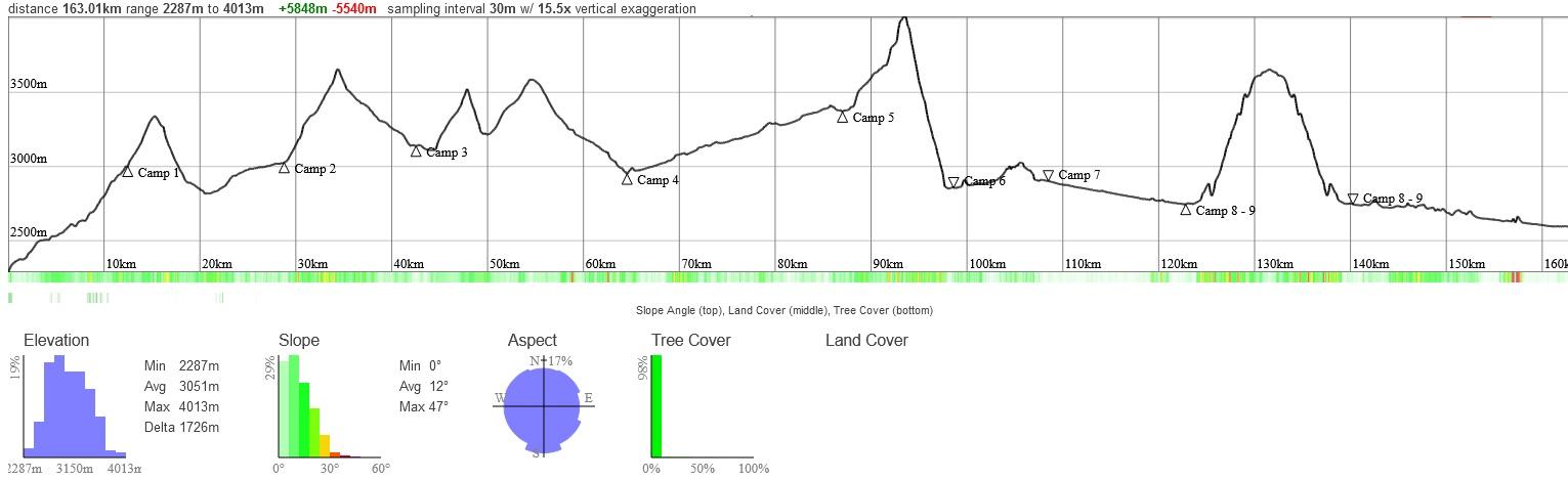
Day 1 : Trek to the foot of Jyrgalan Pass
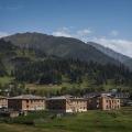
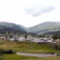
We meet at Victory Square in the center of Karakol at 9:00 a.m. A vehicle will pick us up from here and take us to the mountains. We will drive approximately 1h20 to reach the starting point of our trek in the village of Jyrgalan.
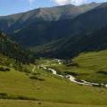
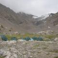
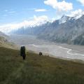
The track begins at 2300 m then joins the Jyrgalan gorge higher up. The forest zone ends, giving way to alpine meadows. In places, we will cross rivers, on bridges. Almost everywhere the track is good. Our camp is on the banks of the Jyrgalan river (3000 m) at the foot of the Jyrgalan pass.
The distance is approximately 12.5 km and will be a little warm-up with a first acclimatization at 2500m / 3000 m. It is best on this day to eat a lot at breakfast and to eat lunch as late as possible. In fact, the day is a day of climbing only, and the more meters we have climbed, the less heavy digestion we will have to manage on the way up. We will then be able to fully rest, and enjoy the view while eating lighter after this great first effort. Protein bars are a good asset for this type of step.
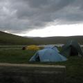
- Night in tent
- All food
- 2 IDTrek guides speaking French/English/Russian and Spanish


Day 3 : Tüp Valley – Ashu Tor Pass – Jylanach Valley
The distance we have to cover today is about 13.7 km, but we have to climb 635 m to the pass whose altitude is 3657 m for a distance of about 5.5 km and descend on the other side up to an altitude of 3133 m. The day is therefore not negligible and you will need to regulate your pace to last until the end.
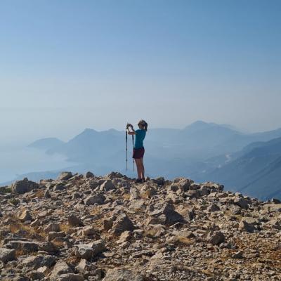
In return, we will enjoy the view of the Tian Shan peaks once at the top, take photos, and have a snack then go back down. We will set up camp near the confluence of the Ashu-Aryk River and the Chon Janalych River.
- Night in tent
- All food
- 2 IDTrek guides speaking French/English/Russian and Spanish

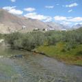
Day 4 : Jylanach Valley – Sary-Djaz Valley
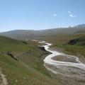
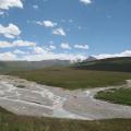
Today we will cross rivers again along bridges and climb the Jylanach pass, passing through ruffled grassy areas, then we will begin a descent along a path to the mouth of the Sary-Djaz river up to an altitude of 3500m.
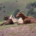
We will have a high probability of seeing mountain goats and the Ular bird.
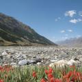
The route is made up of grassy areas in places and canyons in others, going down the gorges to the Sary-Djaz river. The camp will be established in Echkili-Tash, where we will have to have our passports and passes checked for the next area (protected natural area).
- Night in tent
- All food
- 2 IDTrek guides speaking French/English/Russian and Spanish


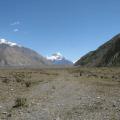
Day 5 : Echkili-Tash (Sary-Djaz) – Tiuz Valley
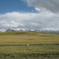
Today we will have to walk about 22 km to the Achik-Tash gorge. We will cross the Sary-Djaz river bridge early in the morning because the road is long. The difference in altitude will be constant and not very noticeable but your endurance will be put to the test after the day before.
Higher in the Tiuz valley (+ 400m), the relief is grassy slopes, and the landscapes are alpine and composed of meadows. The trail will continue until the confluence of the Achyk-Tash and Tiuz rivers where we will set up our camp near the Tiuz river.
- Night in tent
- All food
- 2 IDTrek guides speaking French/English/Russian and Spanish


Day 6 : Tiuz Valley – Enylchek Valley
We will wake up early because we will have to cross the Tiuz river at a ford in the morning when there is little water, then climb the Achyk-Tash gorge to reach the Tiuz pass (+600 m).
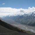
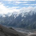
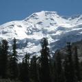
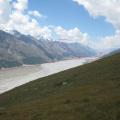
The climb will be on more or less steep and rocky terrain. The pass offers a magnificent view of the entire surrounding landscape: the Enylchek valley, the Enylcek glacier, Nansen peak (5697m) and Vit peak (4215m). As well as many white peaks like Bronenosets (Armadillo) peak, Shokalskogo peak, Petrov peak. The descent from the pass is long and prolonged – 1100 m on steep grassy terrain. It's your knees that will suffer the most this day downhill.
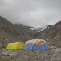
We will set up camp in the Chon-Tash valley near the Enylchek River with a view of Nansen Peak.
- Night in tent
- All food
- 2 IDTrek guides speaking French/English/Russian and Spanish


Day 7 : Enylchek Valley – Foot of Nansen Peak
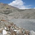
The river in the Enylchek valley is a very large river and its crossing is impossible directly, therefore we will start the day with the transition from the right bank to the left bank, bypassing it to the foot of the glacier.
This bypass will take us through a moraine relief composed of chaotic rocks and ice. At the exit of this moraine, we will follow a good path to the camp. We will set up our camp at the foot of Nansen peak in an easily accessible forest area.
- Night in tent
- All food
- 2 IDTrek guides speaking French/English/Russian and Spanish


Day 8 : Nansen Peak – At-Jayloo
This day will be a relaxing walk, mainly downhill. We will indeed descend along a good path before having to go back up to once again bypass the Enylchek river via an upper path in the forest area. We will exit onto the trail further at the intersection of the Enylchek and At-Jayloo rivers. Here we will cross the river in a ford. From here begins our route for tomorrow to Lake Al-Jayloo. We will set up our camp on or near a special location!
- Night in tent
- All food
- 2 IDTrek guides speaking French/English/Russian and Spanish


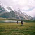
Day 9 : At-Jayloo Camp – At-Jayloo Lake – At-Jayloo Camp
Today we are going on a radial hike. We will start the day with the At-Jayloo gorge and climb the trail for approximately 1000m of elevation gain. The relief will begin in a wood, before joining alpine meadows. As usual we will cross small rivers then we will reach Lake At-Jayloo which offers a panoramic view. We can encounter many animals during the day (mountain goats, marmots, eagles and vultures).
- Night in tent
- All food
- 2 IDTrek guides speaking French/English/Russian and Spanish


Day 10 : Camp At-Jayloo – Moydo-Adyr
The hiking path from At-Jayloo camp to the Moydo-Adyr border post passes along the road, along forest plantations. The distance is almost 23 km but the altitude difference is low and regular. We will need to recheck passports and passes to leave the protected area.
The same day, we will return to Karakol. We will drive about 5-6 hours, the distance – 160 km.
Passports must be with you throughout the trek!!
- Night in tent
- All food
- 2 IDTrek guides speaking French/English/Russian and Spanish


Additional information :
Altimetric profile of the trek
New products
-

Trek Between the summits and glacial valleys of the Tian Shan - Khan Tengri Peak - Kyrgyzstan
10-day trek east of Kyrgyzstan to the borders of China with views of splendid glacial valleys and isolated...1 560,00€ inc. tax
Details -
The great crossing of Reunion - GR R2 - France
13-day trek covering Reunion Island from North to South, mainly along the GR R2, with detours which...3 360,00€ inc. tax
Details -
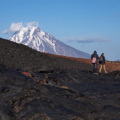
Tour from Tolbachik Volcano to Kurile Lake / Geysers Valley - Kamchatka
Come and discover Kamchatka in all its splendor on foot and by adapted transport, cross large expanses...4 200,00€ inc. tax
Details -
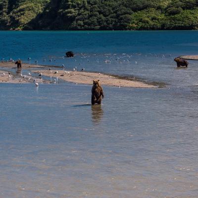
The wilderness of Kamchatka : bears, killer whales and volcanoes
True wild expanses to discover during 14 days in the middle of the magical scenery of Kamchatka to discover...5 000,00€ inc. tax
Details -
Lycian Way East Part - Türkiye
Trek from Göynük to Karaoz - by land (ascent of mount TAHTALI - 2365m).1 500,00€ inc. tax
Details